Trekking to the Summit of Marojejy
The trail to the summit of Marojejy offers visiting tourists, lemur and birdwatchers or anyone who simply plans to escape into the wild to experience the sights and sounds of the forest on a demanding yet rewarding trekking adventure.

| ||

|

|

|

|

|

|
The trail leads through a varied terrain from low to high-altitude rainforest up until the desolate rocky peak which lies within Marojejy National Park, one of Madagascar's protected nature reserves that has been a UNESCO World Heritage Site since 2007.

At a height of 2,132 metres, the summit falls somewhere short of the ten highest peaks if counting the many summits within the country's several mountain ranges. Nonetheless, Marojejy is the third highest altitude national park in the country, followed by Maromokotra at 2,876 m in Tsratanana National Park, which is the country‘s highest peak, and Pic Boby (2,658 m) in Andringitra National Park, the country’s second highest peak.

| ||

|

|

|
Along the national route (RN3b) between Sambava and Andapa, shortly before the village of Manantenina, the Marojejy Park office welcomes visitors and showcases the diverse flora and fauna with photos and detailed information boards. Tours, guides and porters can be booked here.

The trek towards the park begins in Manantenina 175 metres above sea level. The viewpoint shortly before the park office will give visitors a preview of their days ahead.

The park has 11 species of lemurs with the most unique being the Silky sifaka, the second largest lemur after the Indri indri. The Silky sifaka, locally known as the Simpona, is a highly endangered species that can be found only in Marojejy and Anjanaharibe-Sud Special Reserve. Most lemur species in Marojejy are nocturnal, while some are diurnal and others are cathemeral. The Silky sifaka is one of the day-active lemurs.
Most visitors start walking from Manantenina, although it's possible to drive up until the last village before the park entry, Mandena, which is about two and a half kilometres closer to the park boundary. The walking distance from Manantenina until the first camp is about 9.5 kilometres. After entering the park boundary, the walk is mostly in the shade below the canopies of the forest.

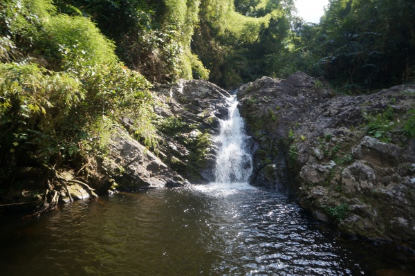
The first camp is Mantella, named after the Mantella frog which can be found in the area. A natural swimming pool with a small cascade offers visitors the opportunity to cool down for a swim before reaching the first camp. The Mantella Camp is 486 metres above sea level.
On the first day, visitors may decide to continue directly to the second camp, Marojejia, or stay overnight at Camp Mantella. The distance between the two camps is a bit over two kilometres along an easy trail that takes about an hour to complete depending on the number of stops to observe the wildlife. Camp Marojejia, named after the palm species in the area, is at an elevation of 744 metres.

| ||

|

|

|

|

|

|
The Takhtajania, the oldest flowering plant in the world can be found near Camp Marojejia. According to fossil records, the plant has been growing on Earth since the days of the dinosaurs 120 million years ago.

Camp Marojejia was rebuilt in 2023 through donations received via the Lemur Conservation Foundation including new bungalows, a terrace, lunch and dining area with an impressive view of the leaning rock boulder facing the camp.

The forest around the Marojejia camp area is where most wildlife can be found. With the help of guides and lemur trackers, it's also most likely to encounter groups of the Silky sifaka here and spot the rare Helmet vanga among other species. In addition to the 11 species of lemurs, Marojejy is home to more than 125 species of birds, 150 species of reptiles and amphibians, 30 species of palm trees and 300 species of ferns.
The Simpona Camp is merely over two kilometres from Marojejia. At 1,326 metres elevation, it's the third and last camp closest to the summit. The camp is smaller and more utilitarian compared with the previous two camps. Guests should not expect convenient facilities but rather the luxury of nature itself.

| |||
|
|

|

| |

|

|

|
|
Visitors sometimes underestimate the stretch between the second and third camps by its short distance and turn back halfway due to the complicated trail. With every step of the trail being different, it's a varied walking exercise that we all have evolved for but have mostly forgotten.

Visitors will come to appreciate the service of the porters who seemingly effortlessly balance guests' excess luggage up and down the trials. Having grown up in villages in the area, the porters are used to the terrain. They also carry food and other provisions to the camps, maintain trails, clear the pathway from fallen tree trunks etc.

A stay for one or more nights at the last camp before setting off on the final stretch may be necessary as access to the summit depends on the weather. During much rainfall, the steep trail becomes slippery and impassable. Under good weather conditions, the approximately two-kilometre distance to the summit will take about two and a half hours. The total ascent is 812 metres and the elevation at the summit is 2,132 metres.


Even on an all-sunny day and for reasons a meteorologist may best explain, the peak is more often than not topped in a cloud which happens somewhat less often in the early morning hours. Set off for the summit as early as 4.30 am / 5 am to hopefully enjoy clear views and catch the sunrise from above the clouds.

A series of short videos of the trek from Manantenina to the summit can be found in the following YouTube playlist:
There is no hotel accommodation shortly before the park entrance except a basic lodge in Mandena. Usually, visitors arrive in the morning hours from Sambava, which is about one hour and 45 minutes by private car hire or two and a half hours by Taxi-brousse. The distance from Sambava is 65 km. Marojejy visitors typically stay at the Mimi Hotel in Sambava where the tourist office is also located and where tours and park tickets as well as guides can be arranged. Take-away lunch packs with pastries from Mimi's restaurant and pâtisserie can be prepared for guests on their journey ahead.
The best period to visit Marojejy is between March and December. During much rainfall, the park is mostly closed, especially the trail to the summit.
Tours can be booked via specialised tour operators including international and domestic flights:
Alternatively, local arrangements can be made via AGEMA (Association for Ecotourist Guides of Marojejy and Anjanaharibe-Sud). Its approximately 30 members are certified by Madagascar National Parks. Dealing directly with the local guides can offer the best value for both visitors and the guides. Most of the guides, all of the porters, cooks, forest guards and workers maintaining the trail are from the local communities.

|

|

|

|

|

|

|

|

|
When the local population become more engaged and reliant on ecotourism than farming alone, the forest's park boundaries are better respected as local communities avoid unnecessarily clearing land for farming purposes in and around the forested area.

| ||

|

|

|

|

|

|
Visiting the park helps preserve nature's precious resources and promotes a mutually beneficial relationship between the local communities, nature and wildlife.
Additional information
- Marojejy National Park on MadaCamp
- https://www.lemurreserve.org
- https://en.wikipedia.org/wiki/Marojejy_National_Park
- https://www.parcs-madagascar.com/parcs/marojejy.php
- https://www.mosaique-malgache.com/circuits/trekking-pn-marojejy
- AGEMA Association for Ecotourist Guides of Marojejy and Anjanaharibe-Sud
- https://www.wildmadagascar.com/en/marojejy-national-park
- https://madagaskar.travel/north-tour-with-marojejy/
- https://www.madagascar-tourism-expeditions.com/tours/soft-adventures/adventure-and-wildlife-expeditions-marojejy-national-park-8-days
- https://ndaoitravel.com/madagascar/en/about-us/
- https://explorewildmadagascar.com/marojejy-national-park/
- https://malagasy-tours.com/contact-us/
- https://m.facebook.com/story.php?story_fbid=1000875958071762&id=100044481007597
- https://m.facebook.com/story.php?story_fbid=1000916221401069&id=100044481007597