Difference between revisions of "Nandrahanana"
From MadaCamp
CampMaster (talk | contribs) |
CampMaster (talk | contribs) |
||
| Line 1: | Line 1: | ||
| − | '''Nandrahanana is a village | + | '''Nandrahanana is a coastal village along the national trail leading around the [[Masoala]] peninsula.''' |
{| class="imageTable" | {| class="imageTable" | ||
| Line 13: | Line 13: | ||
|align="right"|[[File:Nandrahanana 022.jpg|196px]] | |align="right"|[[File:Nandrahanana 022.jpg|196px]] | ||
|} | |} | ||
| − | |||
<googlemap version="0.9" lat="-15.592330" lon="49.924677" zoom="9" controls="large" style="width:100%;max-width:600px;"> | <googlemap version="0.9" lat="-15.592330" lon="49.924677" zoom="9" controls="large" style="width:100%;max-width:600px;"> | ||
-15.592330, 49.924677 | -15.592330, 49.924677 | ||
| Line 19: | Line 18: | ||
</googlemap> | </googlemap> | ||
| − | The village south of Nandrahanana is [[Ambanizana]]. The village direction north is [[Iaraka]] | + | The village south of Nandrahanana is [[Ambanizana]]. The next village in direction north, following some fisherman hamlets, is [[Iaraka]]. |
View all [[Nandrahanana photos]] | View all [[Nandrahanana photos]] | ||
Revision as of 15:25, 22 April 2018
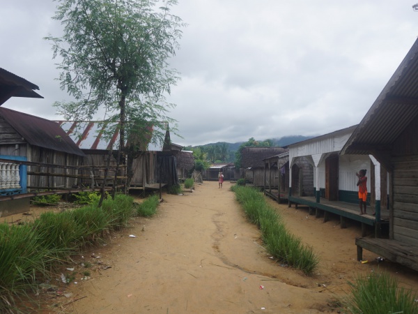
Nandrahanana is a coastal village along the national trail leading around the Masoala peninsula.

| ||

|

|

|

|

|

|
The village south of Nandrahanana is Ambanizana. The next village in direction north, following some fisherman hamlets, is Iaraka.
View all Nandrahanana photos