Difference between revisions of "Diego to Joffreville by bike"
From MadaCamp
(→Tour data (from Joffreville to Diego Suarez)) |
|||
| Line 12: | Line 12: | ||
Distance: 32.67 kilometres<br> | Distance: 32.67 kilometres<br> | ||
Duration: 2 hours, 49 minutes<br> | Duration: 2 hours, 49 minutes<br> | ||
| − | Average speed: 11.59<br> | + | Average speed: 11.59 km/h<br> |
Minimum elevation: 51.51 metres<br> | Minimum elevation: 51.51 metres<br> | ||
Maximum elevation: 831.30 metres<br> | Maximum elevation: 831.30 metres<br> | ||
Revision as of 05:43, 21 September 2019
Bike tour from Diego Suarez to Joffreville, the former stronghold of the French colonial army and gateway to Montagne d'Ambre National Park.

After leaving Diego Suarez direction south, follow the RN6 passing the airport. Soon thereafter a secondary road splits to the right. Turn in and bike along this road until reaching Joffreville.
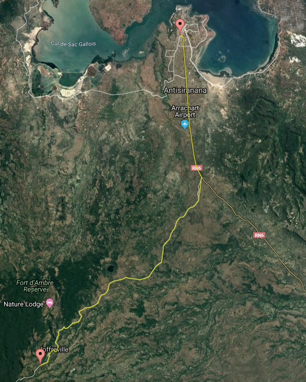
Tour data (from Joffreville to Diego Suarez)
Date: 23rd May 2019
Distance: 32.67 kilometres
Duration: 2 hours, 49 minutes
Average speed: 11.59 km/h
Minimum elevation: 51.51 metres
Maximum elevation: 831.30 metres
Total climb: 85 metres
Total descent: 788.82 metres
Photos
View all Diego Suarez to Joffreville by bike photos
Madabike
Bicycle rental: Madabike.com