Difference between revisions of "Masoala National Park"
| Line 1: | Line 1: | ||
'''The Masoala National Park is located on the Masoala peninsula in the north-east of Madagascar. The peninsula is enclosed by the Indian Ocean in the east and [[Antongil Bay]] in the west. On and around the Masoala peninsula are several protected areas. The Masoala National Park combined with the Nosy Mangabe Special Reserve within the bay is the largest nature protected area in Madagascar.''' | '''The Masoala National Park is located on the Masoala peninsula in the north-east of Madagascar. The peninsula is enclosed by the Indian Ocean in the east and [[Antongil Bay]] in the west. On and around the Masoala peninsula are several protected areas. The Masoala National Park combined with the Nosy Mangabe Special Reserve within the bay is the largest nature protected area in Madagascar.''' | ||
| + | |||
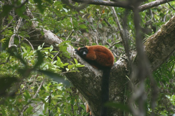
| + | [[File:402.JPG|600px]] | ||
Masoala National Park is one of six national parks on the east coast of Madagascar, all of which were declared a ''World Heritage in Danger'' by UNESCO under the combined name [http://whc.unesco.org/en/list/1257 Rainforests of the Atsinanana] in 2010. | Masoala National Park is one of six national parks on the east coast of Madagascar, all of which were declared a ''World Heritage in Danger'' by UNESCO under the combined name [http://whc.unesco.org/en/list/1257 Rainforests of the Atsinanana] in 2010. | ||
| − | |||
| − | |||
The entire Masoala protected area has a total surface of 240,520ha and is divided into four terrestrial sections and three marine zones: | The entire Masoala protected area has a total surface of 240,520ha and is divided into four terrestrial sections and three marine zones: | ||
Revision as of 15:01, 13 January 2013
The Masoala National Park is located on the Masoala peninsula in the north-east of Madagascar. The peninsula is enclosed by the Indian Ocean in the east and Antongil Bay in the west. On and around the Masoala peninsula are several protected areas. The Masoala National Park combined with the Nosy Mangabe Special Reserve within the bay is the largest nature protected area in Madagascar.
Masoala National Park is one of six national parks on the east coast of Madagascar, all of which were declared a World Heritage in Danger by UNESCO under the combined name Rainforests of the Atsinanana in 2010.
The entire Masoala protected area has a total surface of 240,520ha and is divided into four terrestrial sections and three marine zones:
- The main land plot covers 227,020ha of forest
- The detached land plot of Andranoanala covers 1,300ha
- The detached land plot of Andranomainty covers 1,600ha
- The detached land plot of Beankora covers 620ha
- The marine plot of Tampolo covers 3,600ha
- The marine plot of Masoala covers 3,300ha
- The marine plot of Tanjona covers 3,100ha
The Nosy Mangabe Special Reserve has an area of 520ha.
Masoala is the wettest region of Madagascar, with an average annual rainfall between 2,200mm and 7,000mm. The driest months are from September to December. The tropical humid and warm climate is typical for eastern Madagascar. In general the temperature varies between 24°C in January and 21°C in August.
The Masoala peninsula is very uneven in its northern and western parts. Further south, the slopes are less steep and a coastal plain stretches between Tampolo and Cap Masoala. The east side descents to a coastal plain with a width of up to 15km. Along the coast, rocks alternate with sandy bays and reefs are located not far from the shore.
How to get there
There are two ways to reach the park, either via Maroantsetra or via Antalaha. The easiest and fastest mode of transport is by plane. Air Madagascar operates scheduled flights to Maroantsetra and Antalaha.
A car ride from Tamatave to Maroantsetra along the RN5 takes about two days (400km) mostly on a very bad road, which is often closed due to cyclones from December to March. Coming from Antalaha, there is a 45km stretch to Andranoanala (Cap Est). During the dry season the ride takes about four hours by 4x4 car, while in the rainy season some bridges may be impassable and rivers must be crossed by pirogue.
Alternatively and if coming by Tamatave, it is possible to reach Maroantsetra by sea. Depending on the season, cargo boats leave three to six times a week from Tamatave. The journey by sea takes between one and two days.
Accommodation
Tampolodge
Fax: +261 020 5772149
Email: f-f@wanadoo.mg
Website: www.masoalamadagascar.com
Masoala Forest Lodge
Tel: +41 52624 1077 (Switzerland)
Email: mea@wanadoo.mg
Website: www.masoalaforestlodge.com
Arol Lodge
Tel: 033 12 902 77
Email: masoala@free.fr
Website: http://arollodge.free.fr/home.htm
Cap Est
Cap Est is the eastern most point of Madagascar and can reached by boat or by trekking from Antalaha or Maroantsetra. The closest town is Ambodirafia.
- La Résidence du Cap
- Hotel du Voyage
